SMC Newsletter: Jan-Feb 2025
SMC Domain Outage and Fix Our domain smc.org.in [https://smc.org.in/en/
A detailed note by Jaisen Nedumpala (Asst. Secretary , Koorachundu Village Panchayat and EC Member, SMC)
"Part IVA Fundamental Duties;
51 A. It shall be the duty of every citizen of India-
(h) to develop the scientific temper, humanism and the spirit of inquiry and reform;” - Constitution of India.
There was a time when the world relied on paper maps to get a spatial idea about a geographical area of interest. But those days are long gone in India - at least for the general public, except for government officials (yes sadly, including me). We now live in an age where the world goes ahead with numerous web or mobile based mapping, routing and tracking services, whereas government officials in the various tiers of the union or state governments still rely on paper maps. Many officials still don't even have a clue about the ease of using such internet based mapping services to make their jobs easier. The overall result of this state of affairs, is the poor quality of spatially relevant service delivery from the government.
Various statutory organs of local authorities like village panchayats, municipalities, municipal corporations etc, routinely meet (most of them are statutory meetings) and make important decisions having direct spatial connections. Many of these decisions evolve into official implementation orders to the different officers under these organs. During discussions in such meetings, it is not practical to carry big paper maps or plans to the different levels of decision making, and properly present them in a useful manner. That is why the developed world relies on GIS, WebGIS or Web Mapping, replacing paper maps for almost all of their spatially relevant jobs.
Village Panchayats are constitutional bodies. Articles 243 to 243O of the constitution of India details the authority and functions of village panchayats. They are local authorities having quasi judicial powers over their jurisdictions including those to asses and collect taxes and cess. In Kerala, they are the implementing agency for various developmental projects and schemes of their own and of the union and state governments. They enforce the building rules, the Coastal Regulatory Zone notification (in coastal areas) etc. They have a role in environmental protection according to the Kerala Panchayat Raj Act 3rd Schedule, which details environmental hygiene, environmental awareness, environmental upgradation and social forestry. The Biological Diversity Act - 2002 constitutes the village panchayat level Biodiversity Management Committee. The Village Panchayat secretary is the secretary of that committee as well.
When I was transferred from the post of Secretary (to the Kizhakkoth Village Panchayat) and joined duty as the Junior Superintendent of Koorachundu Village Panchayat, I felt like, I have landed in an unusual place to work. Yes, the peoples' representatives as well as the Secretary and the subordinate staff were very friendly, kind and cooperative, and the office was a well managed one, considering the other stations I worked earlier. The office became a nice place to work, because of the insightful efforts of the then accountant, Mr. K T Manoj Kumar. He was working there for more than eight years, as Upper Division Clerk and then promoted and posted there as Accountant.
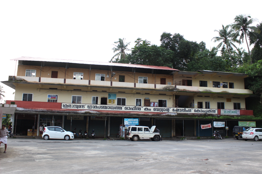 O/o Koorachundu Village Panchayat
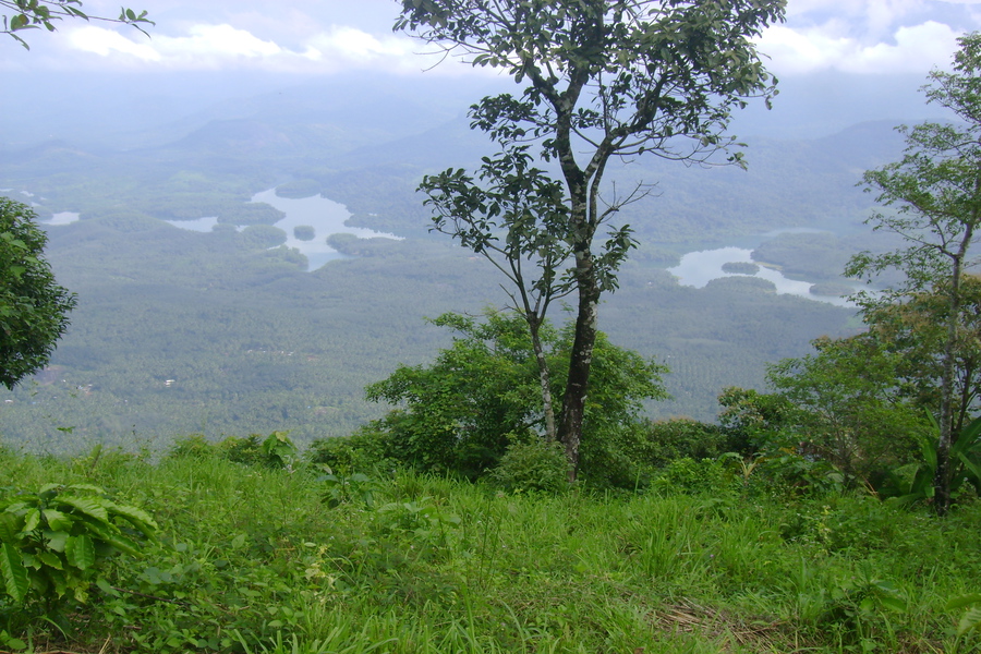
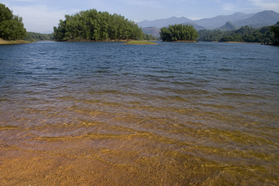
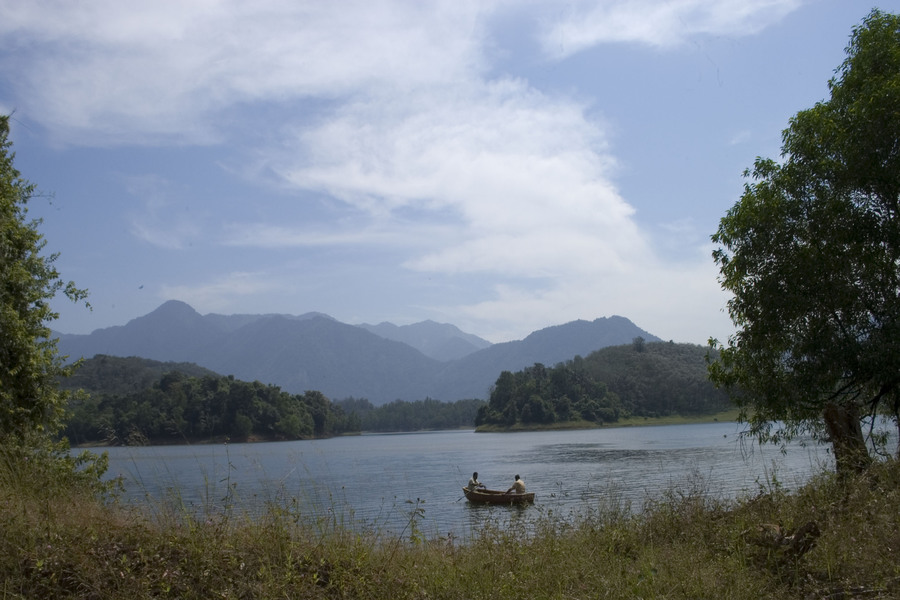
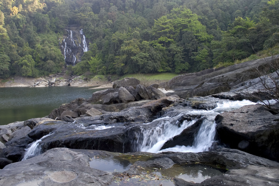
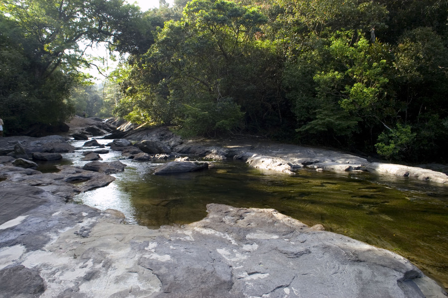
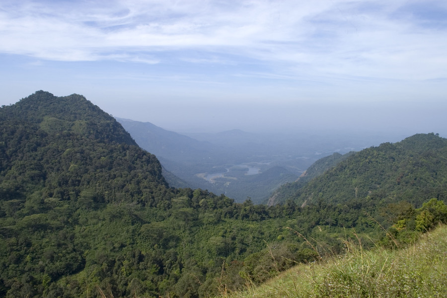
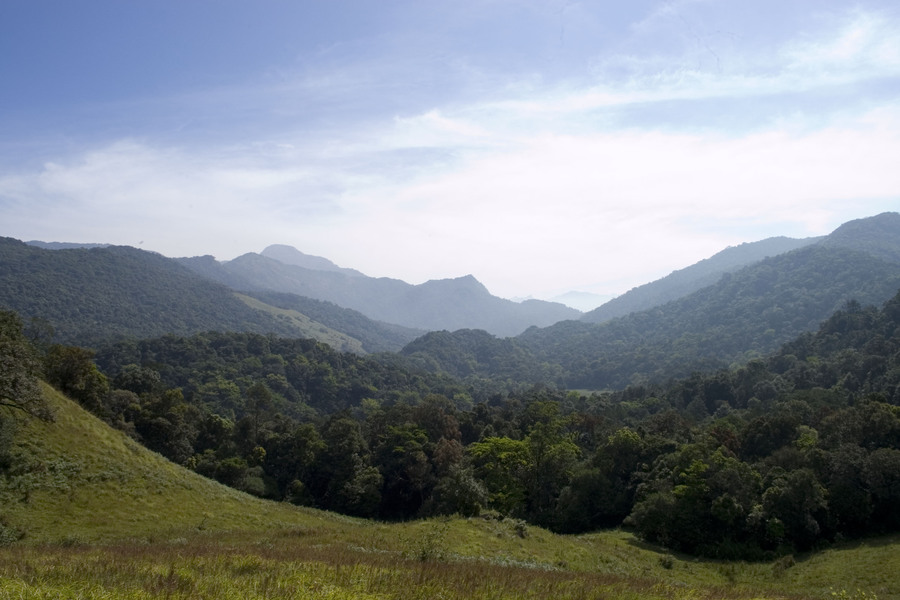
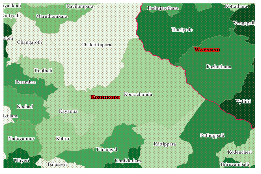
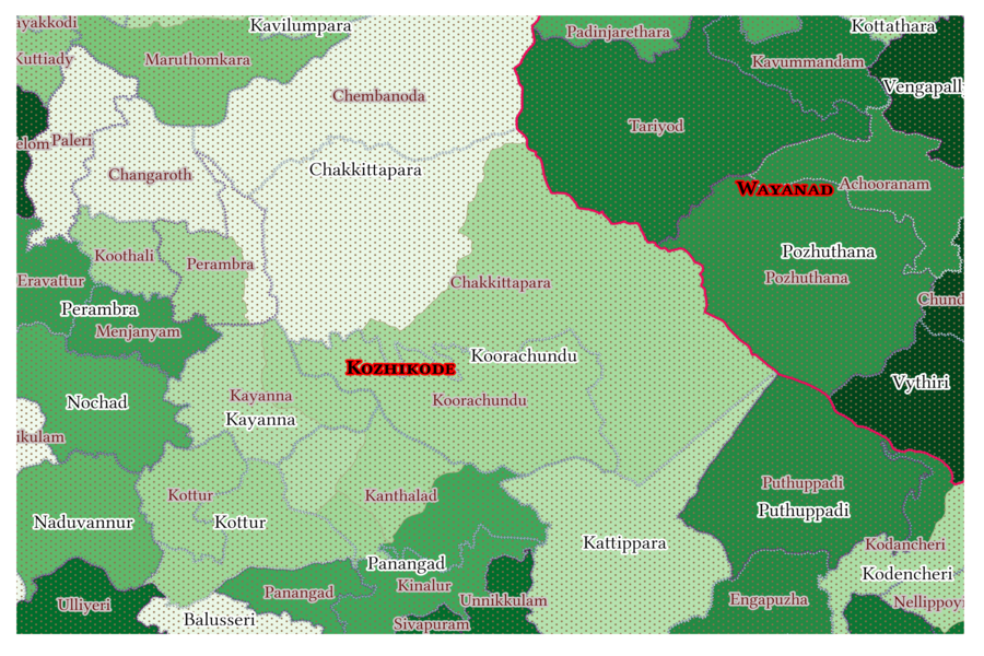
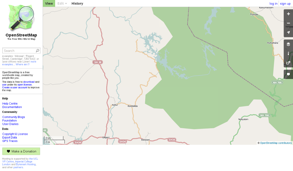
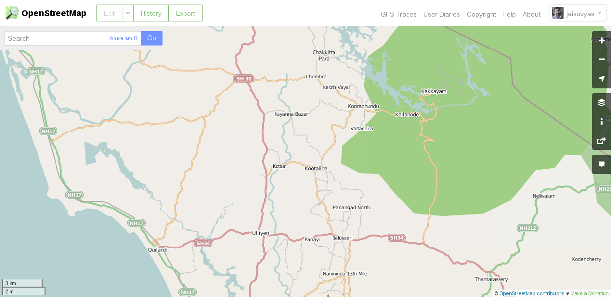
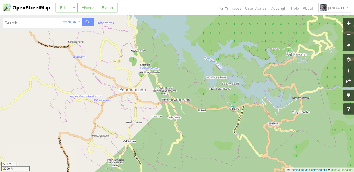
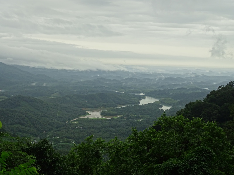
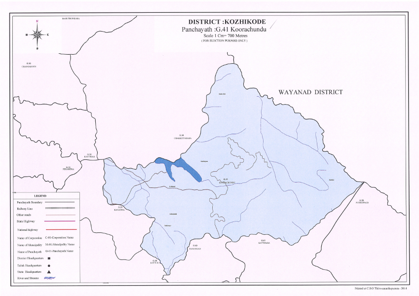
Koorachundu Village Panchayat lies in Kozhikode District and in Balussery Block of Kerala state. It includes the forest area coming under Pervannamuzhi Range, and also includes a part of Malabar Wildlife Sanctuary. The Village Panchayat includes the Kuttiyadi Hydroelectric Project (Kakkayam Dam and reservoir) of KSEB Ltd. A part of Peruvannamuzhi Reservoir of Kuttiyadi Irrigation Project under the Department of Irrigation also lies within this village panchayat. Koorachundu has a very good potential for eco-tourism and related activities.


Initially I felt that I have nothing to do here, so I just carried out my routine duties as usual. I was a bit suspicious about Mr. Manoj Kumar, and about the ways he manages things, in his own peculiar fashion. But, I gradually realised that his management strategies are the best (as far as I know), for a rural local authority. Gradually we began to discuss, plan and work together. President and Secretary gave us their whole hearted support for our ventures. Manoj Kumar got promoted as Junior superintendent when I became Assistant Secretary, and then got transferred to Unnikulam Village Panchayat, where he works now.
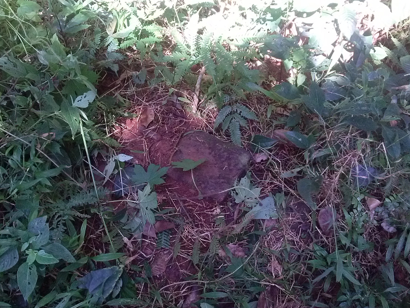
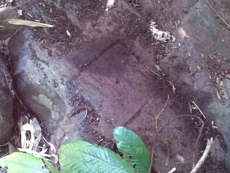
Coming to the mapping, the first reality I noticed was, that Koorachundu Village Panchayat had no standard base map. This was not the case of all the three village panchayats I worked earlier. Cheruvannur Village Panchayat, Kakkur Village panchayat and Kizhakkoth Village panchayat had village level cadastral maps. Chervannur and Kakkur had resource maps too. (Not sure if Kizhakkoth Village Panchayat have or not, as the routine duties of an average village panchayat secretary involves a lot of manual paper works and so is one of a - heavy to handle - kind of job, so couldn't spare time to check that.) But here, most of the area within the village panchayat remain unsurveyed and is divided into four, and comes within the jurisdiction of four village offices namely Koorachundu, Chakkittapara, Kayanna (all three lies in Koyilandy Taluk) and Kanthalad (lies in Thamarassery Taluk). Not a single revenue village comes entirely within this village panchayat. All the four revenue villages share their area with adjacent village panchayats (Yes, revenue village and village panchayat are totally different entities). Also, the village offices here doesn't hold their corresponding cadastral maps. Three of these villages - Koorachundu, Chakkittapara and Kanthalad - are unsurveyed in the sense that the re-survey activities are stalled just before and at the stages under the section 9(2) of the Kerala Survey and Boundaries Act (1961) and the land records were never finalised and settled. We can see several marking stones and rock marks in the field, but those doesn't correspond to finally settled land records. So the village officers here, issue the possession certificates stating that the area is unsurveyed. Along with the need of accurate demarcation of the forest boundary adds more complexity to this. This makes the situation very difficult that, it is virtually impossible to draw an authentic cadastral map for Koorachundu Village Panchayat, right now.
The people of this village panchayat, pay their basic tax to these four village offices, so it created a very inconvenient administrative problem to find out the corresponding village office of the various resident applicants. And, three among these village offices remain too remote from the village panchayat so, the residents have to travel long distances to pay their basic tax. So, the panchayat (in a previous term, I think) took a formal resolution to request the government about re-organising the Koorachundu village, so as to include all the areas of all the wards of village panchayat, excluding all the areas outside the geographical boundaries of the village panchayat. That means, in case of geographical jurisdiction, the revenue viillage and village panchayat will be the same, and all the villagers can pay their basic tax at Koorachundu village office and, the inconvenience in administration also would be solved for ever.
The state government published a notification (Ref: 7) for Koorachundu village re-organisation as stated before. But I think, the notification was published without enough homework and contained some serious mistakes. We will come to this later. Besides that a few motions and resolutions were passed by the village panchayat on this and related issues (Ref: 8, 15, 25 and 27). And on behalf of village panchayat, I also attended several related meetings held at the district headquarters (Ref: 16).
At the same time, the requirement for panchayat map and village cadastral maps were popping up several times. Well, what is the need of maps for a village panchayat? Here are a few:
The Common Guidelines for Watershed Development Projects of Government of India, 2008 (Ref: 4) details two entire chapters about the need of Technology inputs and GIS while preparing plans: Chapter 2. Guiding Principles - V. Capacity Building and Technology Inputs: Current trends & advances in IT & Remote Sensing and and Chapter 3. Technology Inputs - Core GIS facilities, DPR - Resource Maps, Cadastral maps etc.
Under Mahatma Gandhi National Rural Employment Guarantee Act, Village Panchayats need to prepare a Watershed based master plan, as detailed in Watershed Works Manual (published in october 2007 by Baba Amte Centre for People’s Empowerment for Ministry of Rural Development, Government of India). It's two chapters 5 Mapping and 6 Technical Surveys of a Watershed, details the techniques of mapping (Ref: 3). Government of Kerala also issued an order (Ref: 4) stating a list of different types of maps and documents to be used while preparing Watershed based master plan. Here is the list:
Base maps and documents :-
State Perspective and Strategic Plan (SPSP) for Integrated Watershed Management Programme (for IWMP) (Ref: 6), was submitted to Dept. of Land Resources, MoRD, Government of India By Local Self Government Department, Government of Kerala, which talks about the availability of GIS layers of cadastral map at Information Kerala Mission(IKM) in the scale 1:5000.
As instructed by the Kasturirangan Report (Report of the High Level Working Group (HLWG)) State Government issued an order to fix the Ecologically Sensitive Area (ESA). A village Panchayat level verification committee is constituted for field verification purposes, and instructed to fix the ESA and submit a report before 13/01/2014 (Ref: 12, 19, 20, 23, 24, 28, 30, 31, 32).
Government issued a circular (Ref: 29) to constitute “Sevagram” Gramakendram, and an order (Ref: 38) is issued framing the detailed work chart of them. It is an extension centre of Village Panchayat in each ward, important statistics, various maps (political, resource, social, drainage, land use) relating to that ward should be displayed for public information.
The Kerala State Election Commission's handbook named “Good governance through legal awareness - Hand book for People's Representatives and officials at LSGIs" - 2013 (SEC-K & KILA - Page no: 12, 13) describes that ward delimitation should be done using cadastral map. And that will be available at the Information Kerala Mission. If IKM didn't prepare a cadastral map for a particular village panchayat, then that should be prepared with the help of the Survey Department. The State Election Commission issued an order (Ref: 37) which finds that, Local Self Government Institutions of Kerala have no systematically prepared base maps useful for administrative, scientific and academic purposes as an official document. Such a map would be useful as a base document for future delimitation of wards or bifurcation of LSGIs (Ref: 42).
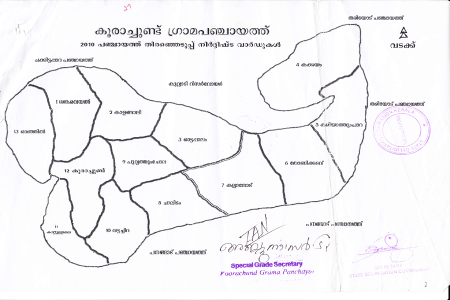
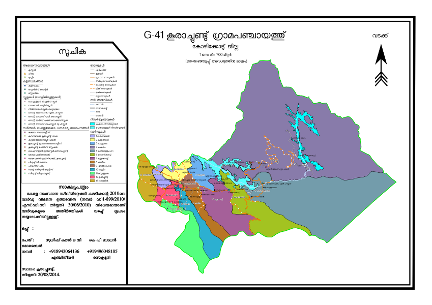
The Reality is that Koorachundu Village Panchayat has no resource map, or cadastral map. But we have an administration map. Here it is:
The State Election Commission's Order (Ref: 37) appeared less scientific to me. It says that, “To be authentic, a map should be prepared by Department of Survey and Land Records.” That is ok. “The maps for village panchayats will be in A3 size and will be in defined scale (municipality: A2 size, municipal corporation: A1 size).” (Initially I couldn't get how to achieve this at the same time, because village panchayats of Kerala vary largely in their geographical area, the largest among them is Kumily in Idukki District, with a huge 816.73 Sq. Kilometers size, and the smallest is Valapattanam in Kannur District with only 2.04 Sq. Kilometers, and all the others lie somewhere in the range in between. But they gave a more clear instruction on how to prepare it, later.) “Department of Survey and Land Records will prepare the final map, using AutoCAD.” This can be better made with the help of any standard GIS Software program. With best of my knowledge and belief, pouring land survey data into CAD is less intuitive than getting it done with the help of GIS.
But there is a hurdle that, the village panchayats can't formulate projects to develop a custom GIS or software program of their own, because of two standing government circulars (Ref: 11), and (Ref: 17). The circulars came in force based on the resolutions of State Level Coordination Committee for De-centralised Planning and the first one was clearly based on the recommendations of the Executive Chairman of the Information Kerala Mission. The first circular enforse some restrictions over the individual software development activities of the Local Self Government Institutions of Kerala. And the second circular prohibits village panchayats from developing a custom GIS for themselves, stating that the Ministry of Panchayati Raj has taken up a big project to develop GIS map of the panchayats of the country, so village panchayats do not formulate projects or make expense for GIS either until the completion of the said project of MoPR, or until the different departments of the state government make a joint policy decision in this matter.
We are abide by the decisions of the government, we are working for. But, I personally believe that Information Kerala Mission has taken away the freedom of village panchayats of Kerala to have their own better technological solutions.
But when I searched for the details of the GIS project initiated by MoPR, in the web, I got an article about their plan, titled "GIS-enabled framework for geo-referenced works under e-governance" published in Geospatial World Weekly on 13 May 2013, by G.P. Singh, Senior Technical Director of National Informatics Centre (Ref: 13). If it is the plan of MoPR to develop a GIS for village panchayats, which considers panchayat boundaries as lowest level, I am doubtful whether it would be good enough to handle the information generated in panchayat levels, precisely. Our GIS needs at village panchayat levels include the data from the survey/resurvey/unsurvey fields, Field Measurement Books of concerned village offices, and high resolution satellite imagery for cross-verification. Also, the details relating to the forest, from forest authorities. The said article says “All the layers should follow uniform projection. WGS84 projection may be considered for uniform projection.” Anyone with basic knowledge in GIS must know that WGS84 is not a projection, but a datum. Besides, now a days it is possible to present the vector GIS data belong to one projection in any other, on the fly.
In my humble opinion, the base GIS data for the village panchayats should be generated in a de-centralised manner, because its accuracy largely depends upon the local knowledge about the survey/resurvey/unsurvey fields, and connected features.
The Village Panchayat and Panchayat Secretary made several attempts to get the shapefiles corresponding to the area to prepare an accurate map through various letters to KSREC, Additional Principal Chief Conservator of Forests (APCCF(FMIS)) (Ref: 21) and IKM (Ref: 22). But all in vain. After several enquiries via phone KSREC replied (only through phone) to pay a very high fee for shapefiles that village panchayat couldn't afford. APCCF(FMIS) issued a soft copy (PDF) of the forest range map, no shapefiles. IKM replied that they haven't prepared a cadastral map for Koorachundu Village Panchayat (Ref: 26).
Here we have several issues to be solved:
Thus I thought to start from the Department of Survey & Land Records (Ref: 34,36,39). and also to make a parallel attempt to develop spatial data with the help of OpenStreetMap volunteers.
Why OpenStreetMap?
OpenStreetMap is a Webmap, which is also a database containing vector map data (Ref:1). It offers freedom to use the data as data is distributed with Open Data Commons Open Database License (OdbL) (It was Creative Commons Attribution Share Alike earlier (CC-by-SA)). OpenStreetMap can be updated easily. It can be edited and updated as a Wiki and users can improve the underlying data at any time. It is a huge repository of GPX tracks of contributing volunteers. Also, it is a community project initiated by a British Entrepreneur named Steve Coast in July 2004. There are many practical difficulties to get vector data to draw custom maps (as we discussed earlier) and mainly because of this, many areas in the world remain to be mapped properly until now. We know that many of the available maps are not free. Few of them are freely available, and come bundled with strict copyright restrictions and thus remain unfit for any customisation purposes. But with OpenStreetMap data, we can draw maps for innovative purposes. Commercially available maps may occasionally contain purposefully added errors. Last but not least, free services delivered by corporates could be stopped, or made to be a paid service, but that usually doesn't occur with the services delivered by communities.
Besides, in case of all types of hazard emergencies, OpenStreetMap data could be available at the finger tip, to plan logistics to transport aid, as happened when 7.0 magnitude earthquake hit Haiti in January 2010 (Ref: 2).
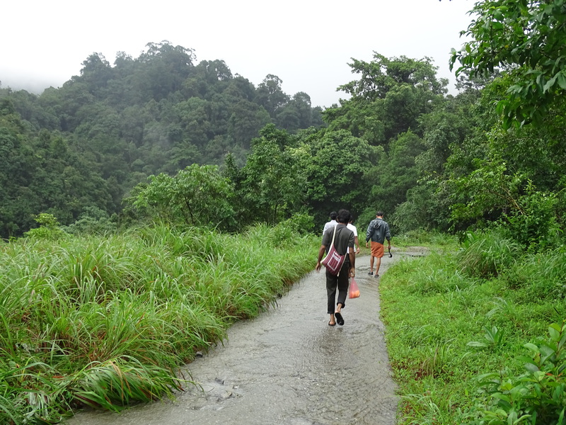
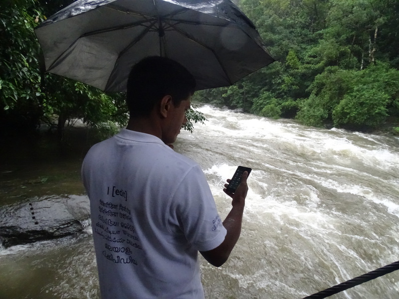
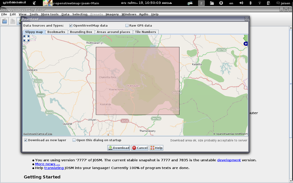
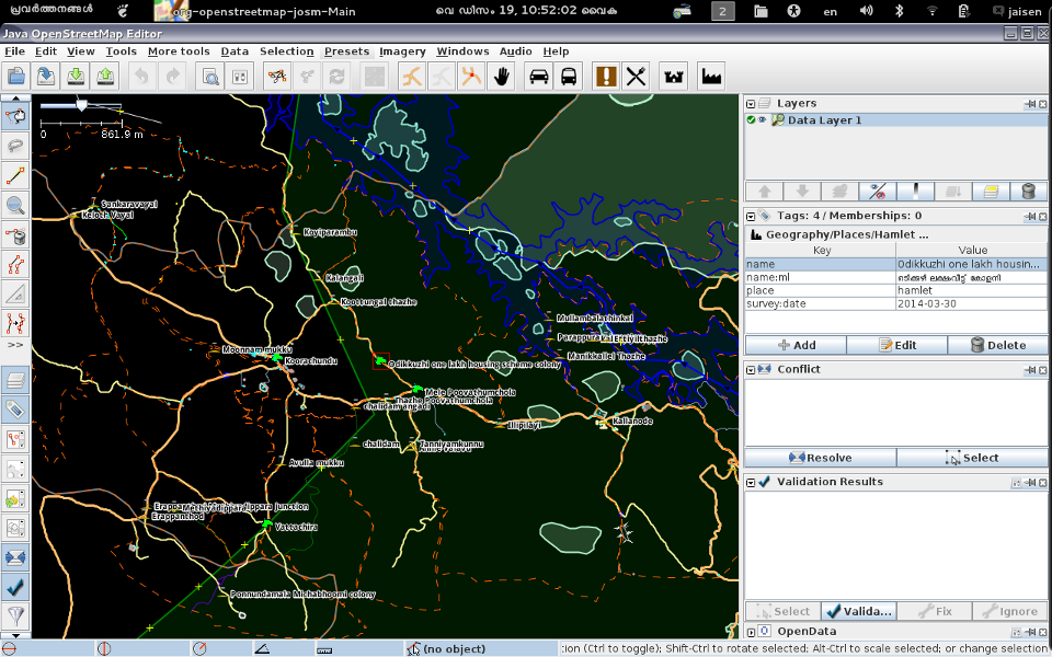
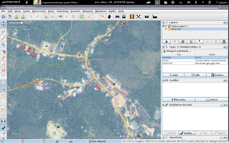
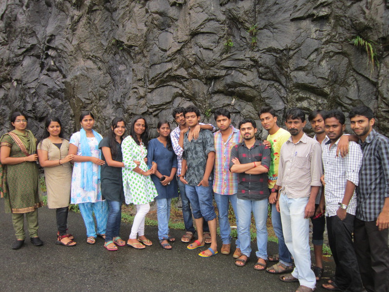
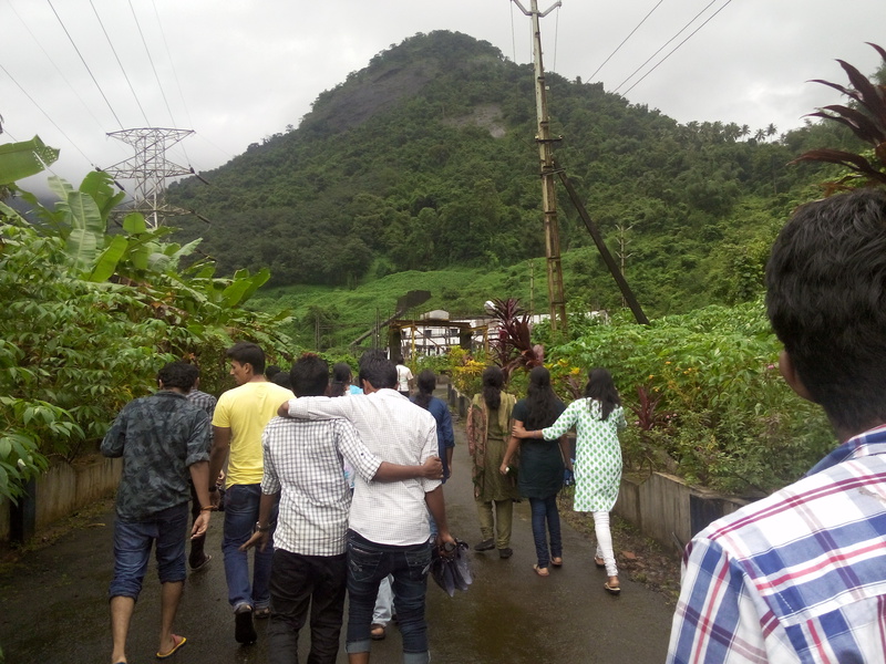
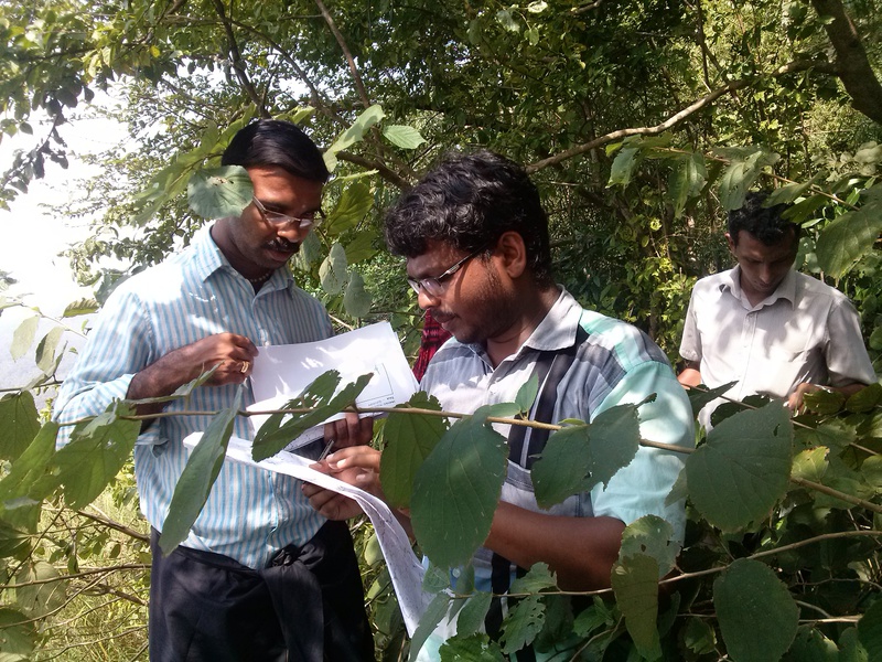
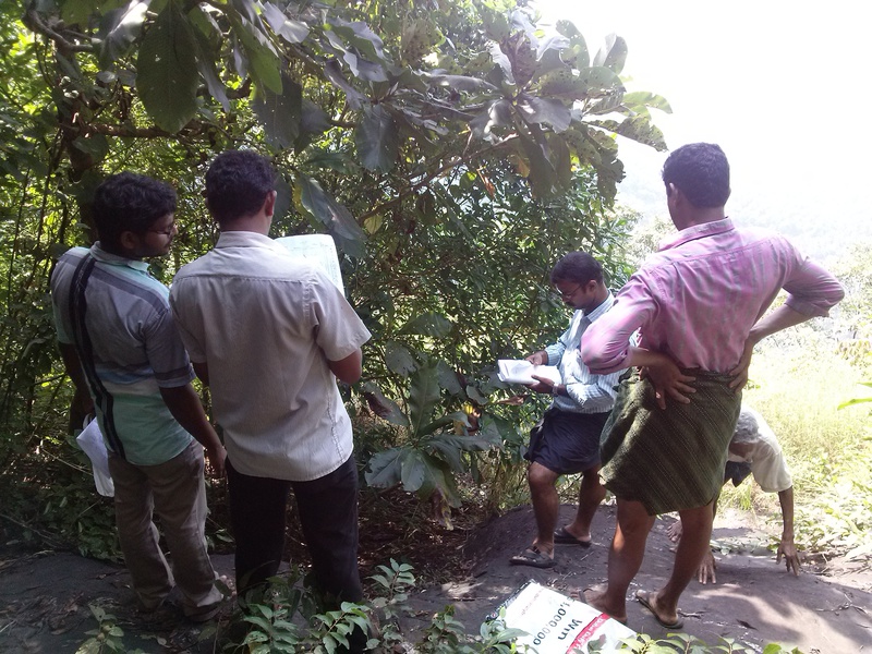
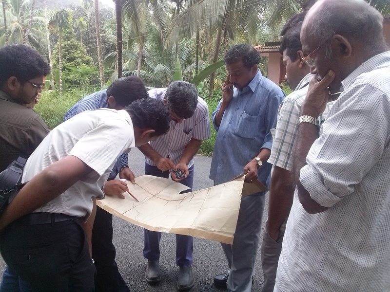
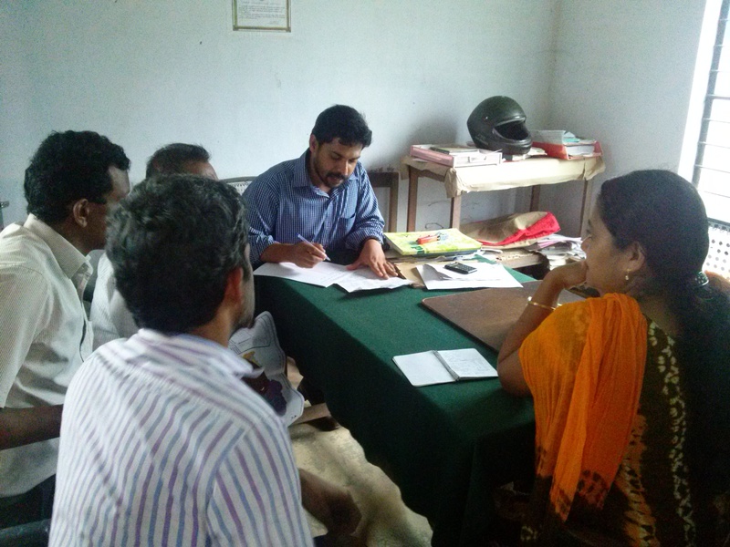
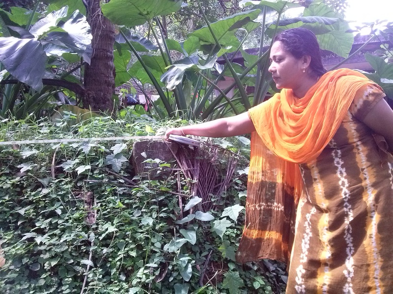
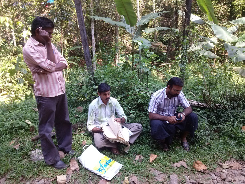
The Koorachundu Village panchayat OpenStreetMap Mapping Party was held in response to the order of the State Election Commission to make an accurate ward map depicting all the polling booths and important public institutions of the area. It was held with the instruction of the Village Panchayat Steering Committee vide resolution no: 2 dated 17/07/2014 (Ref: 41). We conducted the Koorachundu Village panchayat OpenStreetMap Mapping Party to map the area with the official partnership of Swathanthra Malayalam Computing. Twenty OSM – GPS survey volunteers from Swathanthra Malayalam Computing, Wikimedians, and students of Dr. R.Satheesh Centre for Remote Sensing and GIS (Mahatma Gandhi University) and seventeen field level resource persons from the village panchayat participated in this joint volunteer effort, during four days starting from 21/07/2014 to 24/07/2014. They were divided into 13 teams as 1 or 2 OSM volunteers + 1 or 2 resource person would constitute a team. The team which went through forest areas had more members. Food and accommodation for the volunteers were provided by the village panchayat.
Volunteer participants:
Resource persons participated:
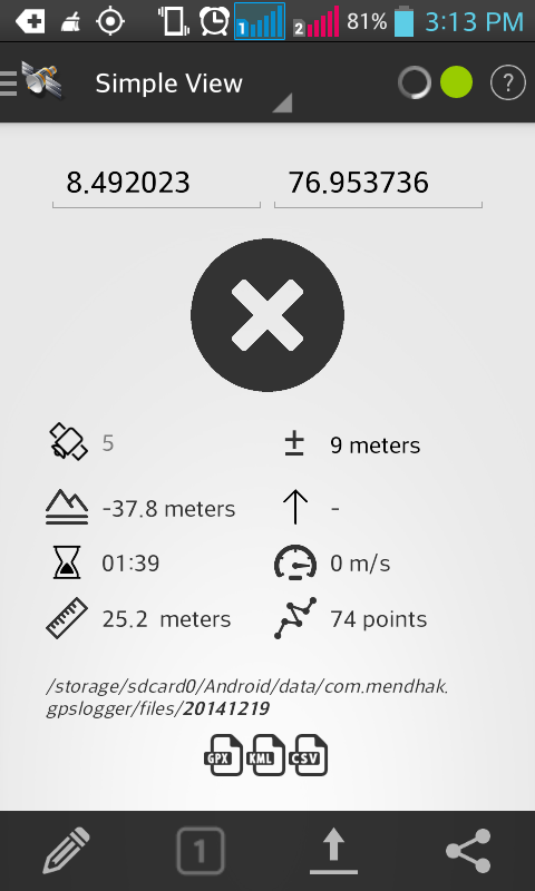
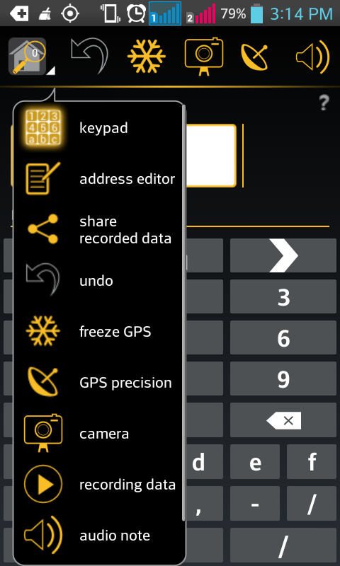
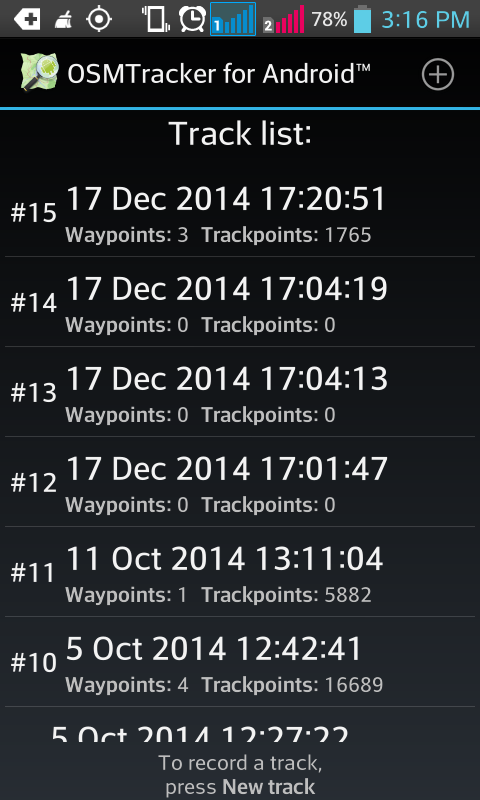
The survey volunteers used Android mobile phones with GPS receiver and three Android Apps namely: GPS Logger for Android (GPL), Keypad-Mapper – OpenStreetMap (BSD) and OSMTracker for Android™ (GPL V3). With these apps GPX tracks and data in OSM format were collected from field.
In Field

Apps
GPS Logger for Android (GPL)


Keypad-Mapper – OpenStreetMap (BSD)


OSMTracker for Android™ (GPL V3)


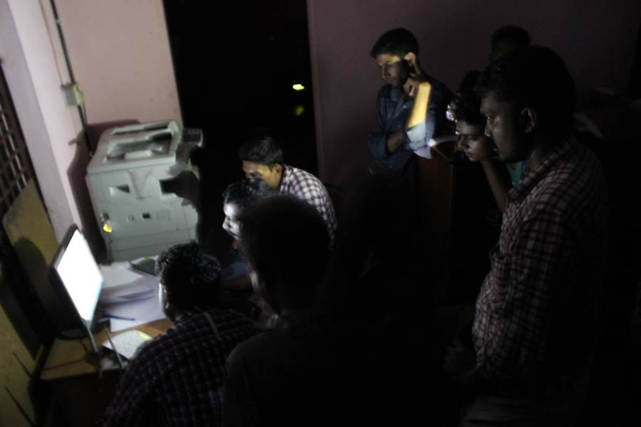
At Desk
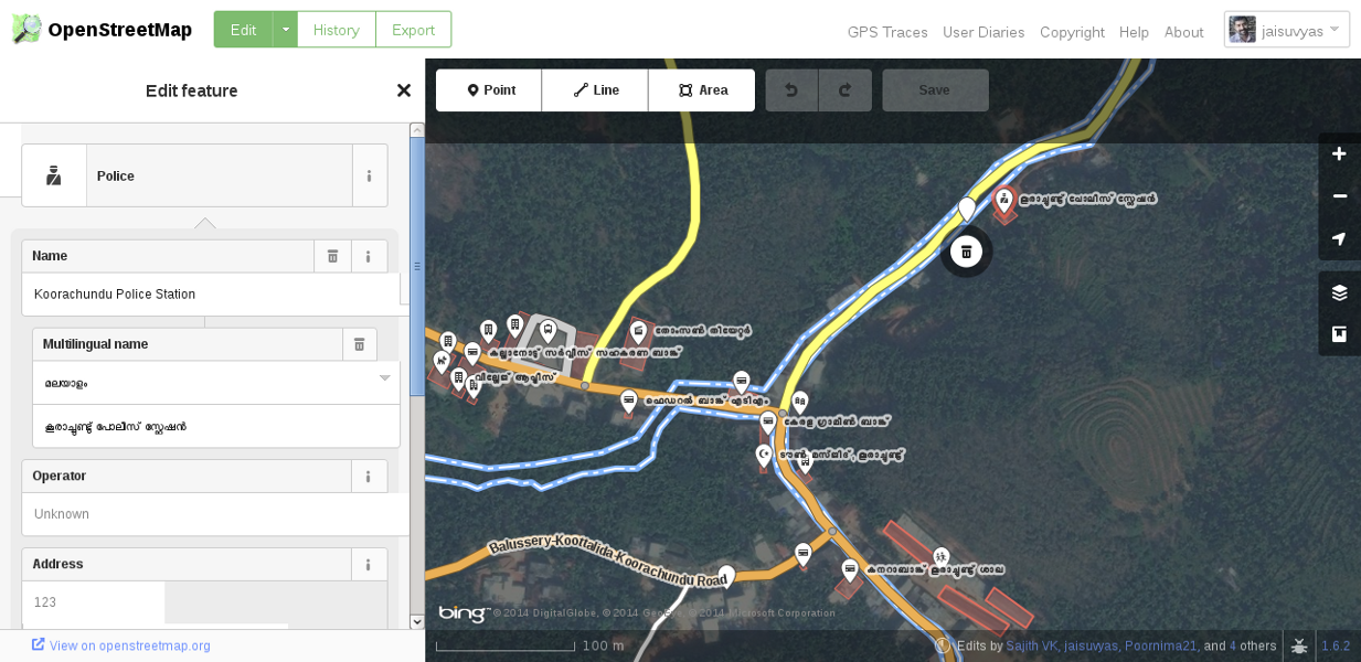
These data are processed at desk using two application programs namely JOSM (GPL) and iD (WTFPL). Microsoft Bing imagery were used for a cross reference.
Tools at desk
JOSM (GPL)
iD (WTFPL)
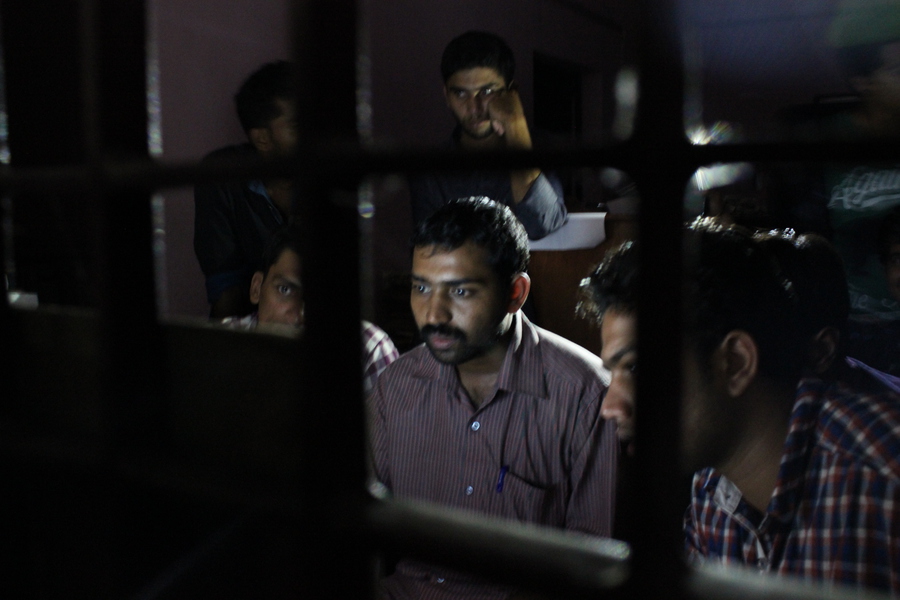
Before Mapping activities
Before Mapping party
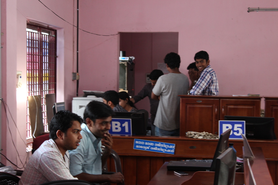
After Mapping party
“This was the first experience ever in my life. It totally improved my knowledge towards my studies. And thanks for giving such an opportunity” – A volunteer
"I feel great experience and I am very lucky to get such a great motivation and support from authorities” – Another volunteer
It was fun as well as a learning and knowledge sharing experience for all of us. :)


Prime Jyoti (SMC) – For suggestions on mapping and tips.
Hrishikesh K B (SMC) – For web support.
John C Mathew - Faculty, Dr. R.Satheesh Centre for Remote Sensing and GIS (Mahatma Gandhi University, Kottayam) - For sending his students for volunteering.
Members of Koorachundu Village Panchayat.
Staff at O/o Koorachundu Village Panchayat.
Medical Officers and staff, Public health establishments at Koorachundu Village Panchayat.
Range Forest Officer and staff, Peruvannamuzhi Forest Range.
Assistant Engineer of KSEB Ltd. in charge of Inspection Bungalow, Kakkayam.
The map was drawn using this data following a standard ETL Procedure:
Boundary map issued by State Election Commission
(Prepared by Central Survey Office, Thiruvananthapuram.)
Ward Map-Administrative (Compromised)
Ark Arjun, who was also a volunteer participant in this effort, helped me with his skills on Inkscape.
The map was duly submitted to the State Election Commission. And the data will be there in OpenStreetMap for future mapping requirements of village panchayat. :)
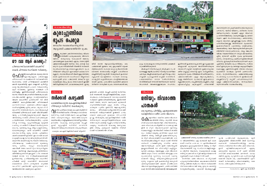
India Today magazine (Malayalam), August 6, 2014 featured this effort.
Yes, we can't achieve the maximum accuracy and precision a GIS can achieve now a days through this method, because hand held GPS receivers show varying error of 2 to 15 meters from actual position, and Microsoft Bing imagery is only a medium resolution imagery as we get here. Also, few of the areas are not covered by Bing imagery. But I can definitely say that this is the most accurate administrative map ever drawn for Korachundu Village Panchayat. Without violating the standing rules, orders and circulars of the Government, I was unable to find some other way to get it done more accurate.
Then what happened to the village re-organisation and cadastral map?
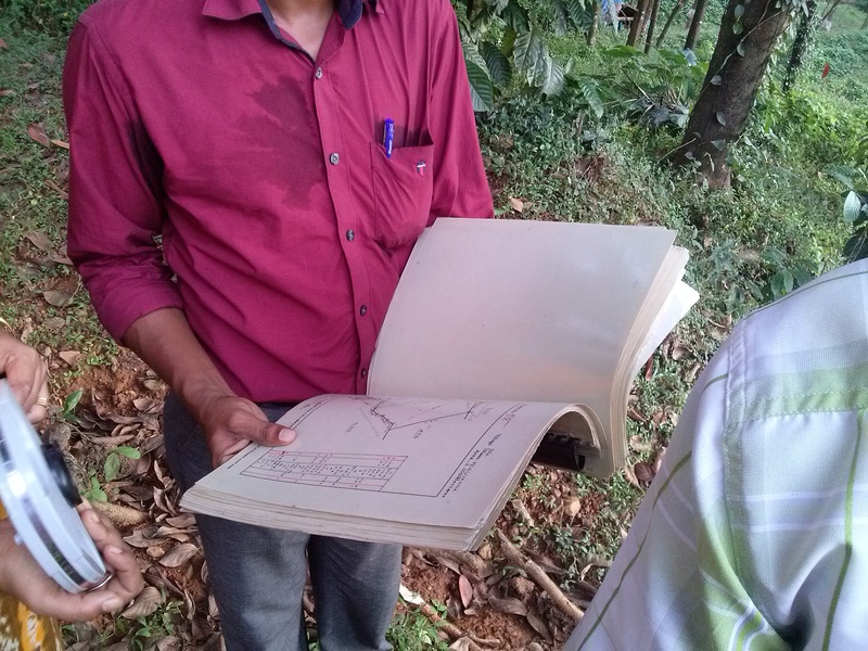
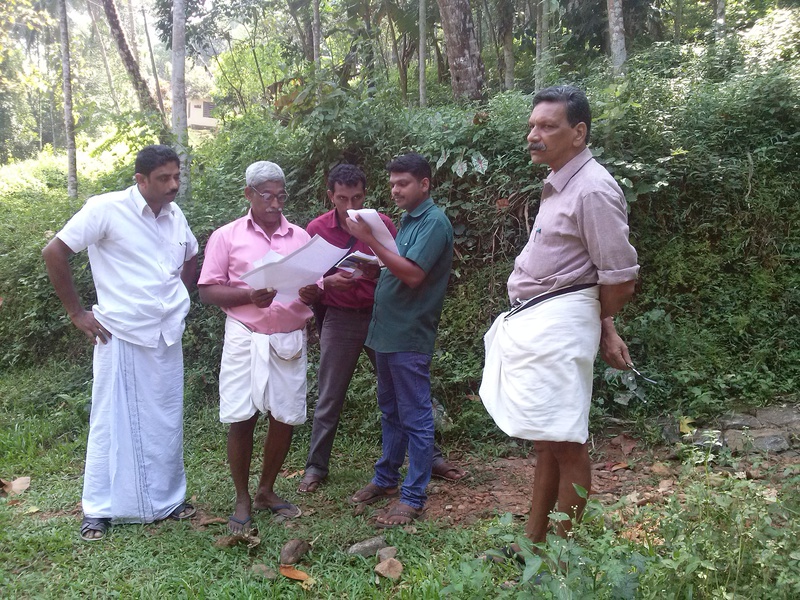
After several meet-ups with Regional Joint Director, Kozhikode and Assistant Director of the Kozhikode Range of Dept. of Survey & Land Records (Ref: 43, 44), and with District Survey Superintendent, Kozhikode, two surveyors - Shinju and Irshad prepared a draft Cadastral map based on current notification (Ref: 7), and presented at the panchayat. And found that draft map includes a few areas outside the village panchayat and also it didn't included a few areas inside the village panchayat - so it made a difficult condition that it couldn't be implemented as such. It was decided to conduct a joint verification of the area to solve the issue, with the participation of three parties: 1. Department of Survey & Land Records, 2. Four Village officers of this area, and 3. The village panchayat. Shinju and Irshad – surveyors - were deputed from the office of the Assistant Director (Kozhikode Range) on behalf of Dept. of Survey & Land Records for this task. I also participated in this joint verification on the days: 20/10/14, 19/11/14 and 26/11/14, on behalf of village panchayat.
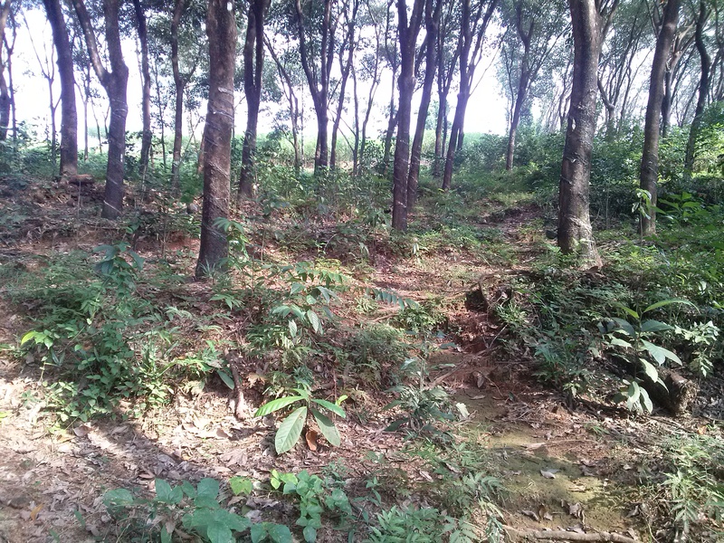
Boundary line between Koorachundu Village panchayat and Chakkittapara Village Panchayat run through the middle of this rubber plantation.

The joint verification is finished now and the documents have been handed over to the Tahsildar, Koyilandy by the District Survey Superintendent, and now under consideration of Taluk Head Surveyor. Hopefully, after the corrected notification got published by the State Government, this issue could be solved once and for ever. When we get the certified cadastral map from the Department of Survey & Land Records, after the corrected notification got published by the government, the corresponding pages of Field Measurement Books will be collected from the village office and individually georeference and digitise them using Differential GPS along with the cadastral map for the sake of precision. This could form the base GIS data (Shapefiles and GeoDatabase) of the newly reorganised revenue village. The data generated by mapping party need to be enhanced with more added features, and can be overlayed above this as a detailed layer to make up the detailed map of the area. That map and GeoDatabase can be used as base GIS data for all future mapping needs of the Village Panchayat.
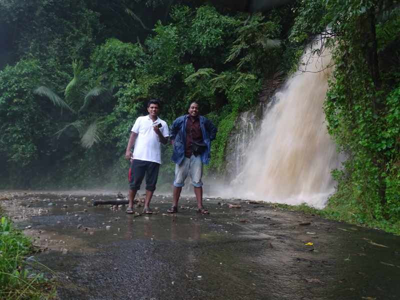
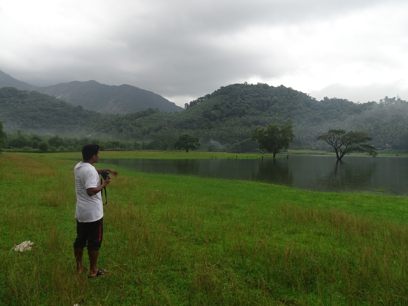
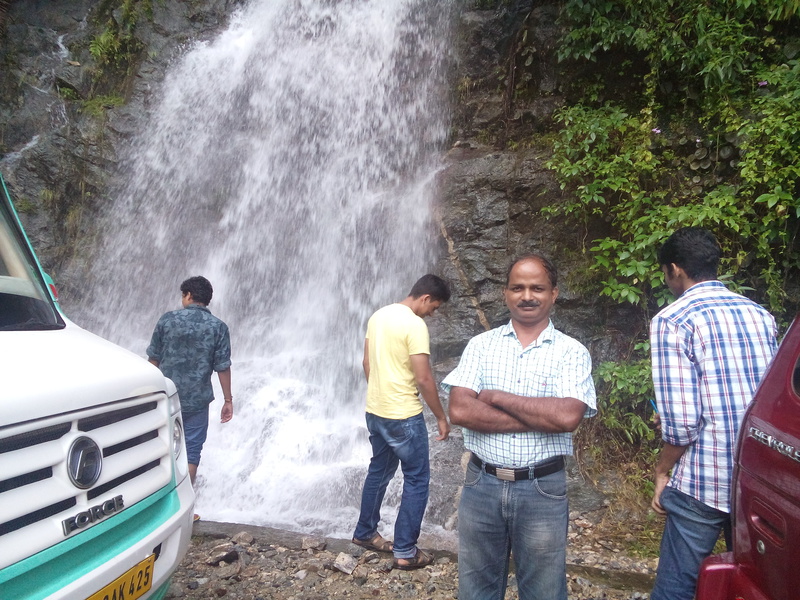
Photographs from stock file of O/o Koorachundu Village Panchayat, from the mapping party volunteer participants and from those clicked by myself.